
JFK Suspects Use Google Earth To Plan Terror Attack
by Anorak | 4th, June 2007

 GOOGLE helps democracy? And alleged terrorists:
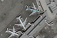
JUNE 4–One of the plotters behind the alleged scheme to explode gas pipelines at John F. Kennedy airport directed his co-conspirators to use Google Earth to obtain detailed aerial photos of the targeted facility. In a federal criminal complaint, one of the accused, Abdul Kadir, reportedly told cohorts to use the popular satellite software after he determined that surveillance video shot by the men was “not sufficiently detailed for operational purposes.”
Posted: 4th, June 2007 | In: Reviews Comment | TrackBack | Permalink