
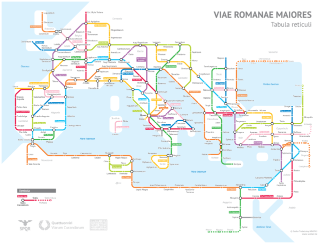
A Tube-style diagram of major Roman roads, ca. 125 AD
by Anorak | 7th, June 2017

This map of Ancient Roman roads (ca. 125 AD) in the Tube / Metro / Subway style is the work of Alexandr Sasha Trubetskoy, an undergraduate economics student at the University of Chicago. Using Stanford’s ORBIS model, the Antonine Itinerary, The Pelagios Project and a little bit of educated guesswork, Alexandr’s map will help any time traveller get around the Roman Empire.
Spotter: CityMetric
Posted: 7th, June 2017 | In: Strange But True Comment | TrackBack | Permalink